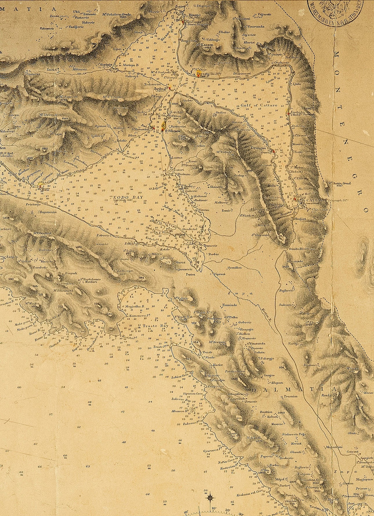
Map of ports and anchorages in Dalmatia and Albania. From the Austrian Government survey of 1870. From Port Molonta to Malaluka Bay, showing approaches to Port Kotor. With an inset map of Port Budva. Published at the Admiralty on 1 August 1878, under the superintendence of Captain F. J. Evans, London
Paper, 68 x 83